|
Chapter Two
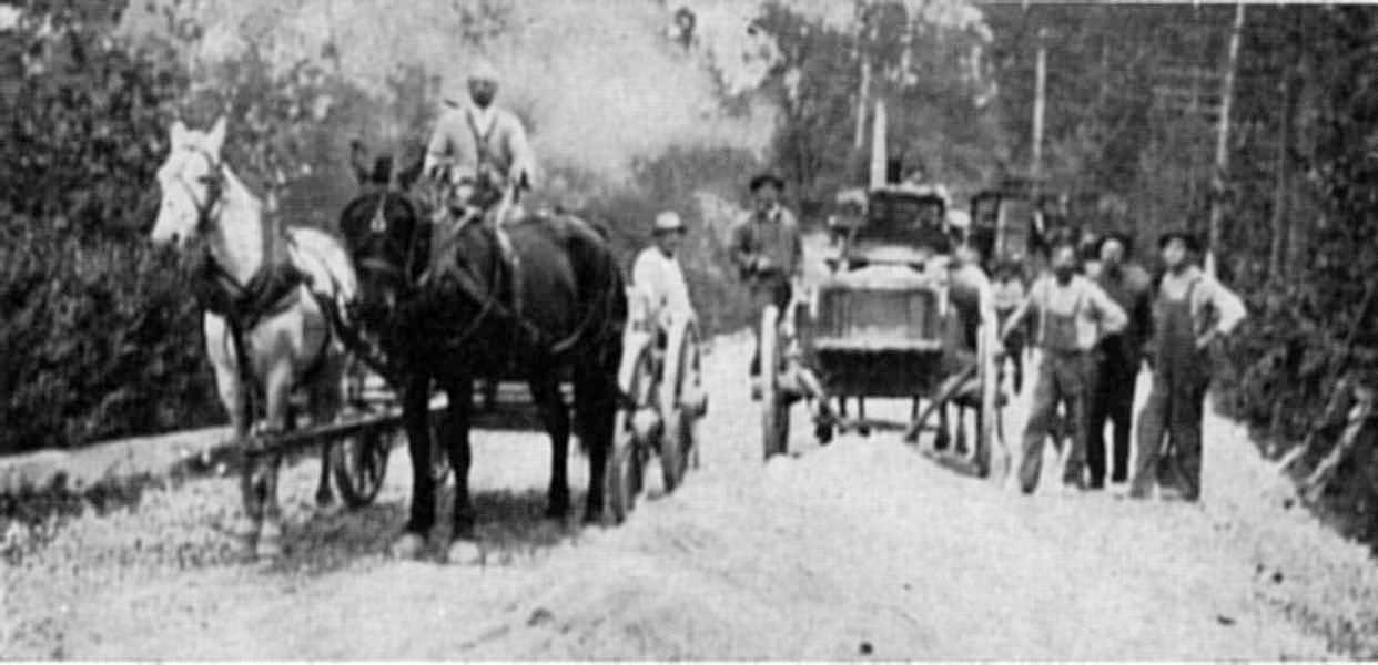
Road Work
Ripple Dam
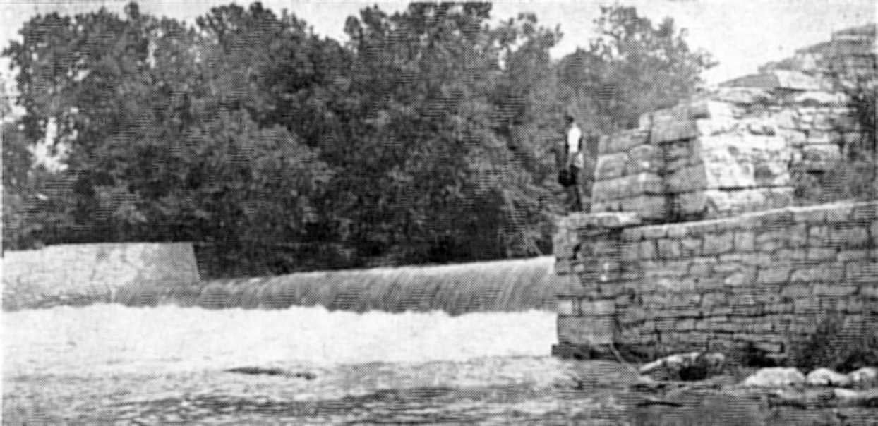
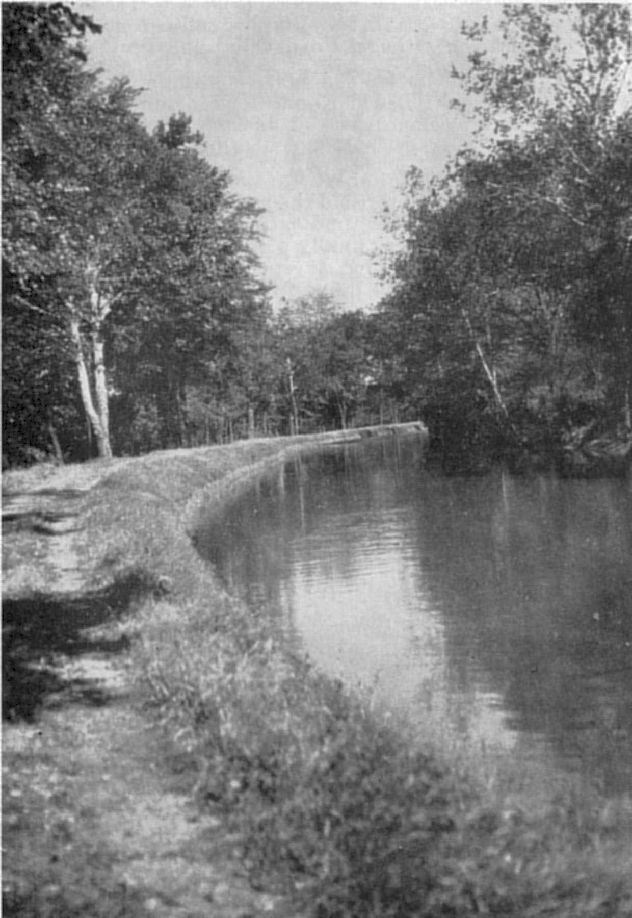
Ripple linked to city Before the completion of the canal from Broad Ripple to Indianapolis in 1839, the only connection the Broad Ripple-Wellington settlers had with the Indiana capital was a single dirt road. This road, first called the "Range-Line", was later named the Westfield Road, then Westfield Pike, and finally Westfield Boulevard. Travelers had to pay an approximate 10-cent toll to use the old Range-Line Road. In the early days, it was customary for men to gravel roads and then set up toll gates so that they might receive compensation for their work. Before the bridge at 64th Street was constructed, travelers entering the Broad Ripple area from the north had to ford White River. Large stones, about 40 feet from the east river bank served as gauges to indicate the water level. If the rocks were visible above the water, then the river was shallow enough to ford. However, if the rocks were covered by water, the travelers knew that the river was too deep to cross. After fording the river at 64th Street, travelers approached the River Road at the entrance to Broad Ripple. A toll was collected on the road to finance the building of the bridge that was to be built across the river at 64th Street. In later years, the area residents cleared roads and named many of them after American patriots and heroes. Settlers in Broad Ripple named streets after Jacob Coil, the founder; Andrew Jackson; Ben Franklin; and Thomas Jefferson. Wellington residents named one street after John Hancock. January 27, 1836, the Indiana General Assembly enacted an "internal improvement" bill which called for the construction of an Indianapolis link to the Central Canal. The project, headed by John Burke, was started in either late 1836 or early 1837 with the building of the Broad Ripple feeder-dam across the ripples in White River just north of the settlements of Broad Ripple and Wellington. Burke hired mainly Irish workmen for the canal job and added to their pay jiggers of whiskey. Most of the canal route was covered by forests which had to be cleared by hand. It is estimated that one man died for every six feet of canal dug, principally from strain and fever. This canal, which separated Broad Ripple and Wellington, yet connected the two villages with Indianapolis, was only a small part of the Central Canal, which was to extend from the Wabash and Erie Canal at Peru, Indiana, through Indianapolis, and back to the Wabash and Erie at Worthington, Indiana. The entire canal project was a great undertaking, for when completed, it would have been 459 miles in length and, thus, the longest canal in the world. The canal appropriations became exhausted, however, and the canal was never completed. The funds for the Indianapolis portion of the canal, which amounted to approximately $1,600,000, ran out in 1839 when the Indiana state treasury was left bankrupt by the Internal Improvement Program. Only 8.79 miles of the canal had been completed by that time. When the Broad Ripple-Indianapolis portion of the canal was opened for business, an elaborately decorated, silver-colored packet boat, appropriately named the "Silver Bell", offered the fastest travel in the state - eight miles an hour. A line of canal boats, pulled by mules on a tow path, was operated by Robert Earl. He advertised his canal service as such:
Boat leaves Indianapolis at 10:00 in the morning and returns at six in the evening. Good order at all times will be preserved. Fare one dollar. Persons visiting Broad Ripple are assured that good entertainment will be found by those desiring eatables, etc. Earl also built a flat-bottom boat and, at Burke's suggestion, christened it the "David Burr" in honor of the commissioner of the Wabash and Erie Canal. This boat and the rest of Earl's flatboat service saw a great deal of use during the 1844 presidential election between Clay and Polk when social "political" parties were held on the boat decks. On a fishing trip made on one of Earl's boats at this time, one patron got into such a heated argument with a political opponent that he thoughtlessly took a step backwards and fell into the canal. This incident probably led to the rumor that unruly people attending these "political" parties were thrown overboard.
The coming of the first railroad to Indianapolis in 1847 began a great railroad boom in Indiana, which eventually made it the "crossroads of America".
Enterprises, such as Earl's canal service, failed when the locomotive proved the more profitable form of transportation, and the canal era came to an end.
In 1851, the state finally sold the canal to private investors for less than $2,500.
After this sale, the canal ownership changed many times.
In 1869, the canal was sold for $200,000 to the Indianapolis Hydraulic Company, now the Indianapolis Water Company.
The Water Company still uses the canal as a main source of water for the Indianapolis area.

Contents
|