|
|
Broad Ripple History


Pictures, Stories, Maps, and more
Brought to you by Broad Ripple Publishing
|
|
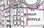
1925 Map showing annexation areas The original Town of Broad Ripple boundary Map courtesy of the George F. Cram Co. Inc. Indianapolis | ||
click images for larger photos | ||
 |
||
|
1925 Map showing annexation areas
| ||
|
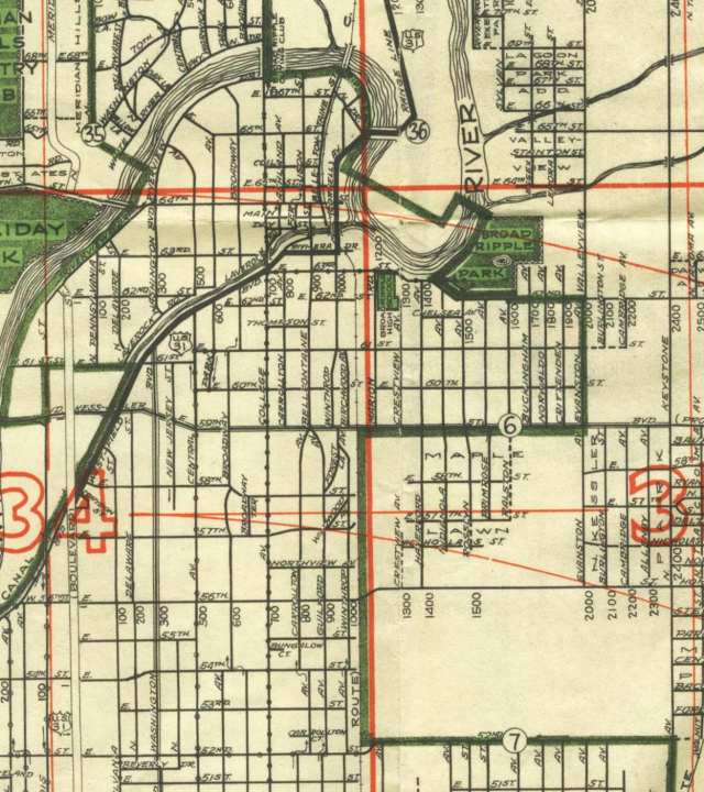
1931 Map showing new city limits The new City of Indianapolis boundary | ||
click images for larger photos | ||
 |
||